Stronger Hurricane Erin Threatens Dangerous Surf Along US Coast/ Newslooks/ WASHINGTON/ J. Mansour/ Morning Edition/ Hurricane Erin has strengthened back into a Category 4 storm as it moves northwest across the Atlantic, threatening the Bahamas and U.S. East Coast with dangerous surf and rip currents. Evacuations were ordered in parts of North Carolina’s Outer Banks. Scientists warn climate change is fueling storms like Erin.
Hurricane Erin Forecast Quick Looks
- Reintensified to Category 4 with 130 mph winds early Monday.
- Located 105 miles north-northeast of Grand Turk Island at 5 a.m. ET.
- Forecast: remains a major hurricane into midweek, despite gradual weakening.
- Tropical Storm Warning: Turks and Caicos, Southeast Bahamas.
- Tropical Storm Watch: Central Bahamas.
- Evacuation ordered: Hatteras Island, Outer Banks, North Carolina.
- Erin reached Category 5 status Saturday with 160 mph winds.
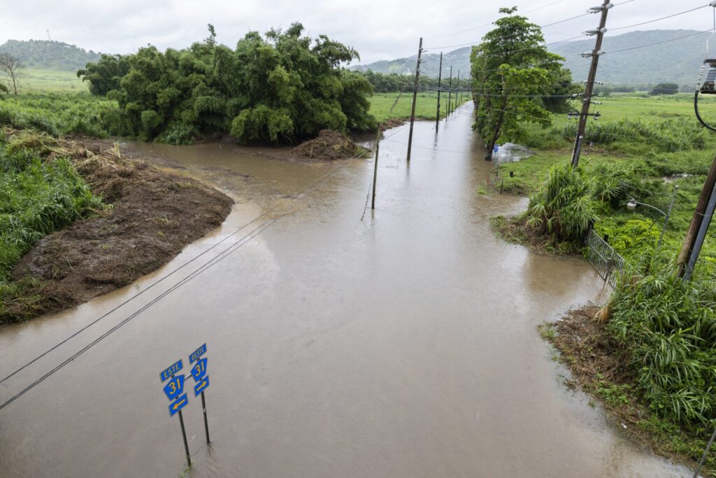
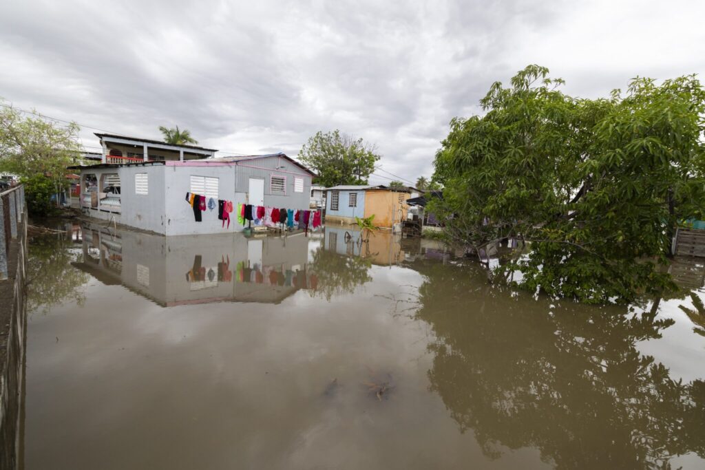
- Outer bands hit Puerto Rico and Virgin Islands, causing 147,000 outages.
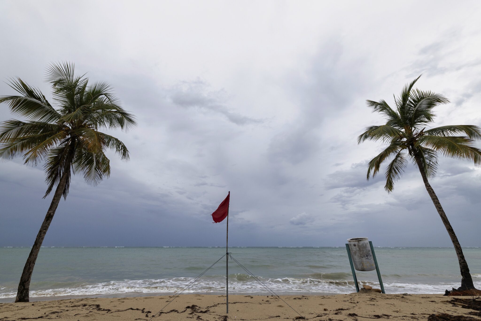
- Rough surf expected from Bahamas to Canada’s Atlantic coast.
- Scientists link rapid hurricane intensification to climate change and warming oceans.
Deep Look: Hurricane Erin Strengthens, Threatens US Coast
‘MIAMI (AP) — Hurricane Erin has reintensified into a Category 4 storm, packing maximum sustained winds of 130 mph (215 kph) as it churns northwest through the Atlantic, the U.S. National Hurricane Center (NHC) reported early Monday.
At 5 a.m. ET, Erin was located about 105 miles north-northeast of Grand Turk Island and roughly 915 miles south-southeast of Cape Hatteras, North Carolina. The storm was moving northwest at 13 mph (20 kph), edging closer to the Southeast Bahamas.
Warnings and Watches in Place
The Bahamas government issued a Tropical Storm Watch for the central islands, while a Tropical Storm Warning remains in effect for the Turks and Caicos and the southeast Bahamas. The NHC said Erin is expected to strengthen further on Monday before gradually weakening but warned it would remain a large and powerful hurricane through midweek.
Hurricane-force winds now extend 60 miles from Erin’s center, with tropical-storm-force winds stretching outward as far as 230 miles (370 kilometers). Meteorologists caution that Erin’s expanding size means it will bring impacts to coastal areas even without making direct landfall.
Evacuations in North Carolina
Officials in Dare County, North Carolina, declared a state of emergency and ordered evacuations for Hatteras Island on the Outer Banks. The barrier island chain, vulnerable to flooding and high surf, faces the possibility of washed-out sections of N.C. Highway 12 due to pounding waves and strong winds forecast over several days.
From Category 5 to 4
Over the weekend, Erin briefly reached Category 5 intensity, with sustained winds of 160 mph (260 kph), before weakening. “You’re dealing with a major hurricane. The intensity is fluctuating. It’s a dangerous hurricane in any event,” said Richard Pasch, a senior forecaster with the NHC.
Impacts in Puerto Rico and Virgin Islands
Erin’s outer bands lashed Puerto Rico and the Virgin Islands Sunday, delivering heavy rains and strong winds that knocked out power to about 147,000 customers, according to Luma Energy. The storm forced the cancellation of more than 20 flights, though ports reopened late Sunday as conditions improved.
Forecast: Rough Seas Along East Coast and Beyond
The NHC warned that Erin’s vast wind field will create life-threatening surf and rip currents across the Bahamas, Bermuda, the U.S. East Coast, and Canada’s Atlantic shoreline into midweek. Dangerous seas are also expected around Puerto Rico, Hispaniola, and the Turks and Caicos.
Climate Change Concerns
Scientists have increasingly linked the rapid intensification of hurricanes like Erin to climate change, pointing to warming oceans that provide storms with greater fuel and an atmosphere that holds more moisture. These conditions allow hurricanes to strengthen at alarming speeds, complicating forecasts and disaster preparedness.
As Erin grows in size and intensity, forecasters stress that even without a U.S. landfall, the storm poses a serious threat from storm surge, rip currents, and high surf up and down the Atlantic coast.