Hurricane Erin Spurs North Carolina Outer Banks Evacuations/ Newslooks/ WASHINGTON/ J. Mansour/ Morning Edition/ Hurricane Erin forced evacuations on North Carolina’s Outer Banks Tuesday, threatening strong rip currents, flooding, and dangerous surf. Though expected to remain offshore, the storm is still producing Category 3 winds and hazardous waves. Officials warn of potential road washouts and prolonged flooding as tourists flee peak season.
Hurricane Erin Quick Looks
- Hurricane Erin prompted evacuations on Hatteras and Ocracoke Islands.
- The Category 3 storm is offshore but packing 110 mph winds.
- Waves up to 15 feet threaten flooding and road closures.
- Rip currents already forced 60 swimmer rescues in Wrightsville Beach.
- Ocracoke’s first evacuation since Hurricane Dorian in 2019.
- Storm surge and flooding expected Tuesday through Thursday.
- Bermuda could face 24-foot swells later in the week.
- Experts link storm intensity to climate change and warming oceans.

Deep Look: Outer Banks Braces as Hurricane Erin Sparks Evacuations, Rip Current Danger
OUTER BANKS, N.C. — August 19, 2025
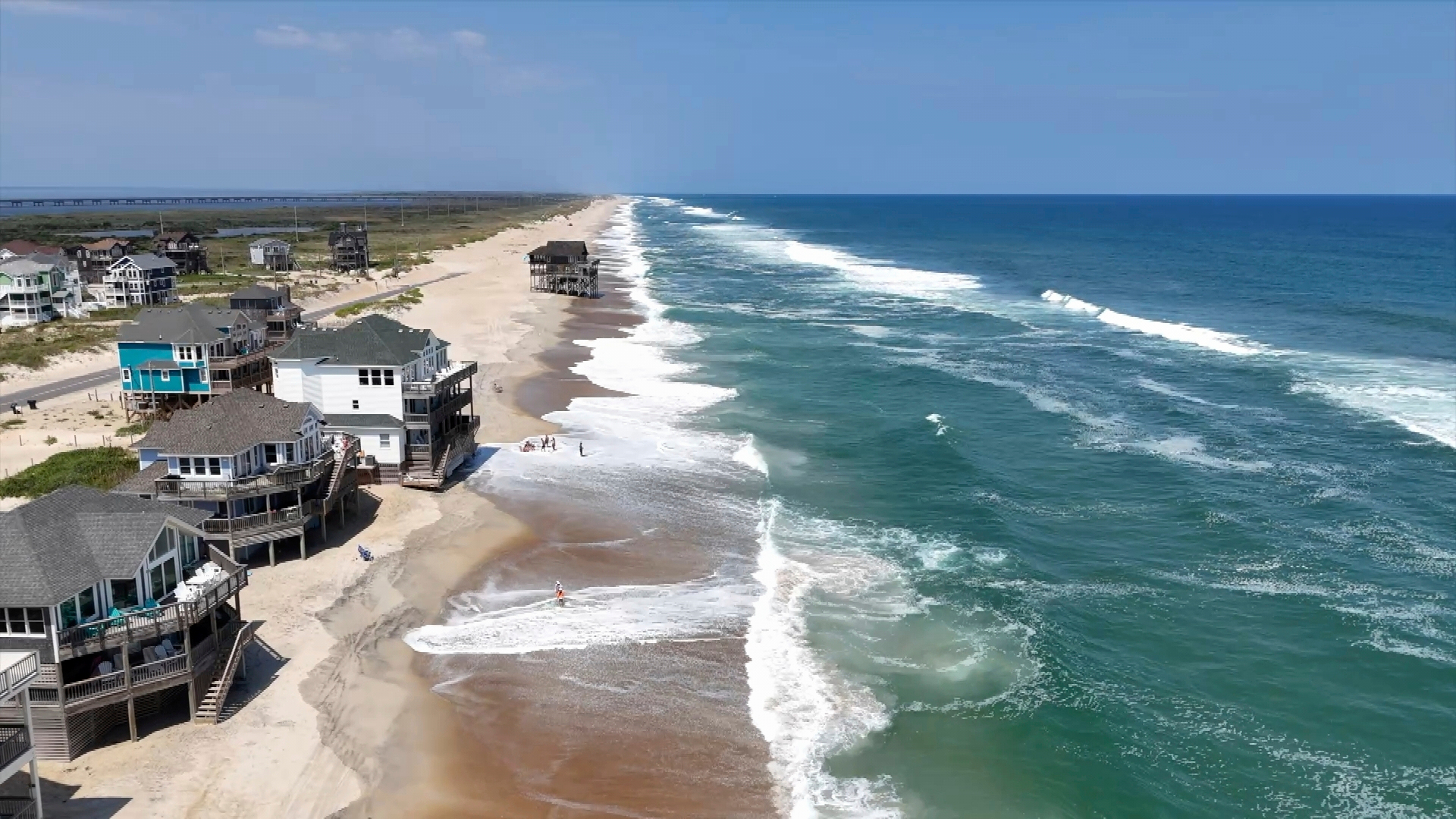
As Hurricane Erin spun closer to the Carolina coast Tuesday, residents and tourists on North Carolina’s fragile Outer Banks scrambled to evacuate. Officials warned that while the storm is expected to remain offshore, it could still send pounding waves, rip currents, and coastal flooding across the barrier islands.
For innkeeper Holly Andrzejewski, the storm came at the worst possible time. Just days after purchasing the Atlantic Inn on Hatteras Island, she was forced to reschedule her first guests. “It’s always a possibility when you live at the beach,” she said, noting she and her family had secured generators, water, and flashlights.
Monster Storm Offshore, But Still a Threat
By early Tuesday, Erin had weakened slightly but remained a Category 3 hurricane with sustained winds of 110 mph, according to the National Hurricane Center. The storm sat about 720 miles south-southeast of Cape Hatteras, moving northwest at just 7 mph.
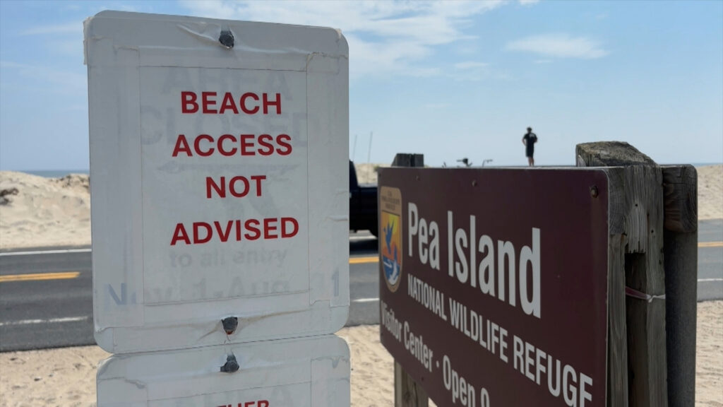
Although landfall is not predicted, the Outer Banks’ exposed geography makes it extremely vulnerable to long-lasting storm surge and heavy surf. Tropical storm watches stretched across much of the area, and forecasters warned of waves as high as 15 feet battering the coast for several days.
Evacuations Ordered
Authorities ordered mandatory evacuations for Hatteras Island and Ocracoke Island, thin slices of land that jut into the Atlantic. The timing couldn’t be worse: peak tourist season. Visitors and residents alike rushed to board ferries or drive inland before routes became impassable.
This is Ocracoke’s first evacuation since Hurricane Dorian in 2019, which inflicted the worst damage in the island’s recorded history.
Grocery store owner Tommy Hutcherson said the community has largely rebuilt but remains cautious: “I thought Dorian wouldn’t be bad, and we got smacked. You just never know.”
Dangerous Rip Currents Already Taking Toll
Ahead of Erin’s approach, Wrightsville Beach officials reported rescuing at least 60 swimmers from rip currents on Monday alone. Such currents are among the storm’s deadliest threats, especially for visitors unfamiliar with Atlantic surf conditions.
“Surfers, swimmers, and boaters must resist the temptation to go out,” warned Bermuda’s acting National Security Minister Jache Adams, as the island braces for the storm later this week. By Thursday, waves there could swell up to 24 feet.
Potential for Road Washouts
One of the greatest concerns for the Outer Banks is damage to the main highway, which runs the length of the barrier islands. Officials worry prolonged battering surf could wash out stretches of road, leaving communities isolated for days.
Last year, even a distant storm—Hurricane Ernesto—caused severe surf and coastal erosion hundreds of miles away from shore. Erin’s prolonged proximity could be worse.
The Science: Climate Change and Rapid Intensification
Hurricane Erin’s strength and persistence mirror troubling trends scientists have long warned about. Rising ocean temperatures provide storms with more fuel, while a warming atmosphere holds greater moisture, increasing rainfall totals.
“This is why we’re seeing more storms go from tropical storms to major hurricanes in record time,” said climate scientist Dr. Alicia Warren.
Erin already lashed parts of the Caribbean with heavy rain earlier this week and remains powerful as it tracks slowly northward.
Local Preparations
Residents on the Outer Banks are used to storm prep: boarding windows, hauling outdoor furniture indoors, stocking supplies. Andrzejewski said her family is staying close to home while monitoring conditions.
“Otherwise, you wouldn’t live at the beach,” she said.
Meanwhile, government services in the Turks and Caicos remain suspended, with ports closed and residents ordered indoors under a tropical storm warning.
What Comes Next
- Outer Banks: Flooding expected through Thursday, with evacuations continuing.
- Bermuda: Likely to see the worst impacts Thursday evening.
- East Coast: Erin projected to turn north, sparing direct landfall but leaving dangerous surf in its wake.
Officials continue urging caution, especially for swimmers and tourists drawn to the waves. Even if the storm stays offshore, Erin is expected to make its presence felt for days along the Atlantic seaboard.