Arctic Air Mass Hits U.S. Amid Flood Threats/ Newslooks/ WASHINGTON/ J. Mansour/ Morning Edition/ A powerful arctic air mass is sweeping into the U.S., triggering dangerously low temperatures across the Midwest and South. Meanwhile, the Pacific Northwest is still reeling from record-breaking floods, with concerns of mudslides and levee breaches. Officials continue evacuations and rescues as the floodwaters recede slowly and more rain looms.
Arctic Freeze & Flood Fallout Quick Looks
- Arctic air is pushing southward from Canada, plunging temperatures.
- Dangerous wind chills reach as far as the Deep South.
- Coldest conditions expected Sunday in Minneapolis and Chicago.
- Freeze alerts issued for Montgomery, Alabama, and Savannah, Georgia.
- Pacific Northwest faces lingering floodwaters, mudslide, and levee threats.
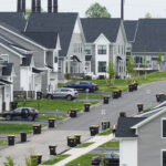
- Washington state towns inundated after days of heavy rain.
- Thousands have been evacuated from flood-hit areas.
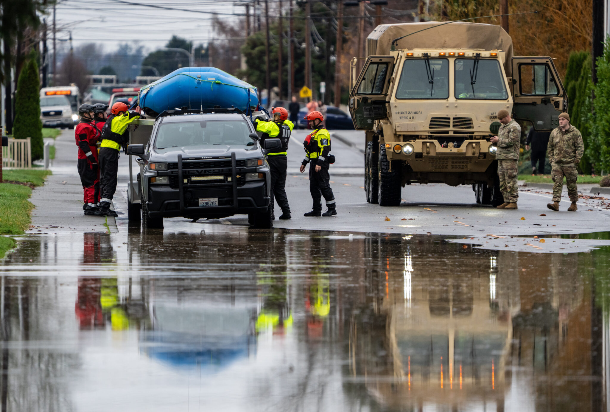
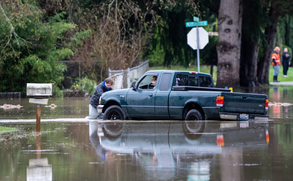
- Emergency rescues conducted from rooftops, vehicles, and farmlands.
- Another round of rain forecast for the region on Sunday.
- Infrastructure damage includes closed highways and washed-out bridges.
Deep Look: Arctic Cold Grips U.S. While Flood-Weary Northwest Braces for More Rain
Dec. 13, 2025 — UNITED STATES — A wave of arctic air barreling south from Canada is sweeping across the northern United States, ushering in bone-chilling temperatures across the Midwest and into the South, while residents of the Pacific Northwest remain on high alert following catastrophic flooding earlier in the week.
From the Midwest to the Deep South: Brutal Cold Arrives
In places like Grand Forks, North Dakota, the thermometer dropped to -12°F (-24°C) by midday Saturday, with the wind chill making it feel like -33°F (-36°C), according to the National Weather Service (NWS).
Big cities including Chicago and Minneapolis are bracing for their coldest temperatures of the season. In Minneapolis, early Sunday lows are expected to fall to -15°F (-26°C), while Chicago is forecasted to see temperatures near 1°F (-17°C).
By Sunday evening, the arctic air mass is predicted to stretch as far south as Alabama and Georgia, with freeze warnings in effect for Montgomery and Savannah, where overnight lows may dip into the low 20s Fahrenheit.
The NWS issued cold weather advisories across multiple regions, warning of hazardous travel conditions, increased energy demand, and risks of hypothermia for those exposed outdoors without proper protection.
Pacific Northwest Flooding: A Crisis Still Unfolding
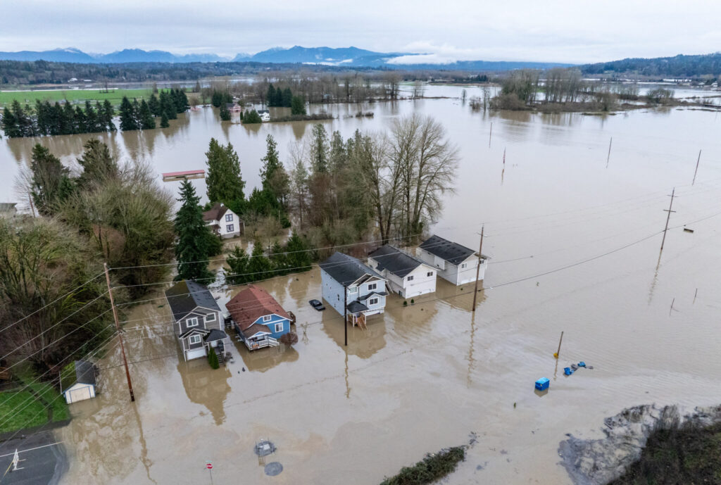
While much of the nation prepares for freezing weather, the Pacific Northwest is still contending with the aftermath of record-breaking floods, the result of an unusually intense atmospheric river that dumped more than a foot of rain across western and central Washington state.
Communities along rivers like the Snoqualmie have been devastated. Among them are Eddie Wicks and his wife, who had to be rescued by the King County Sheriff’s Office after floodwaters engulfed their farm near North Bend. Deputies arrived by boat to save the couple, their dog, two donkeys, and eight goats, as their property became a lake.
Across the region, thousands of residents have evacuated as high waters swamped homes, highways, and farmland. The Shifa and King counties have reported dozens of water rescues, with multiple bridges washed out and major roads blocked by debris and landslides.
Ongoing Threats: Levee Failures, Mudslides, and More Rain
Although floodwaters began slowly receding on Saturday, officials warn that levee breaches and mudslides remain a serious risk. With more rain forecast for Sunday, there’s concern that already fragile areas could experience further flooding or infrastructure collapse.
“We’re still in a dangerous phase of this event,” said a spokesperson from the Washington State Emergency Management Division. “The ground is saturated, and our rivers remain swollen. Even a few more inches of rain could be catastrophic.”
Infrastructure Damage and Emergency Response
Washington’s transportation officials have reported widespread closures, with some rural towns completely cut off due to washed-out roads and collapsed bridges. In addition to physical damage, utilities have been disrupted, leaving some residents without power or clean water.
Local emergency services have established shelters and relief stations, while federal assistance is being coordinated to support cleanup, rebuilding, and medical needs — especially for those displaced or injured.
What’s Ahead?
While the cold snap is expected to spread deeper into the South, possibly reaching parts of Florida by Monday, the Pacific Northwest’s recovery depends heavily on weather conditions over the next 48 hours. A renewed downpour could complicate cleanup efforts, strain levees further, and increase landslide risks.