Wildfires are spreading rapidly in the Western U.S. due to hot, dry and windy weather, resulting in hundreds of evacuations near Flagstaff, Arizona. California is also being hit hard by the fires. The Associated Press has the story:
The number of square miles burned so far this year is more than double the 10-year national average
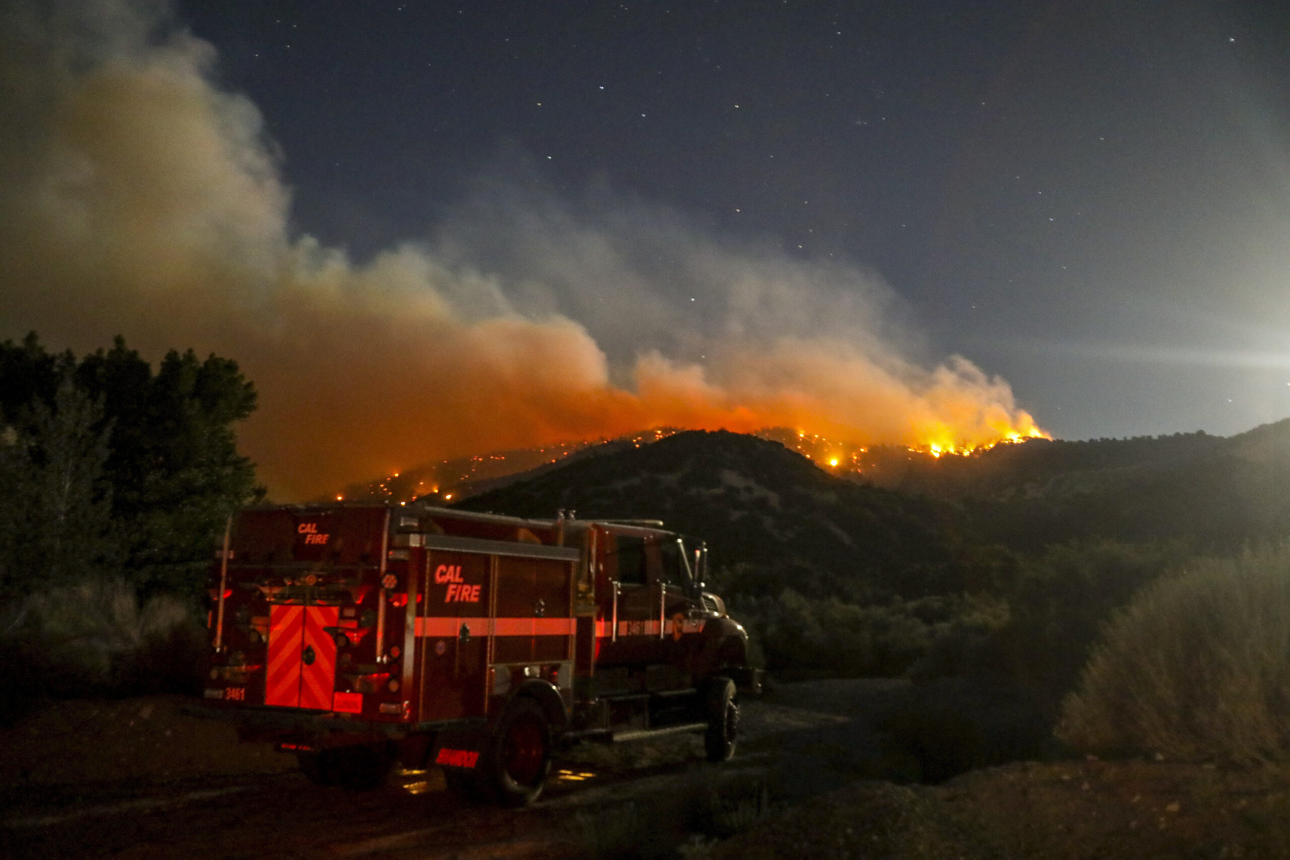
FLAGSTAFF, Ariz. (AP) — The Western U.S. on Monday marked another day of hot, dry and windy weather as crews from California to New Mexico battled wildfires that had forced hundreds of people to leave their homes.
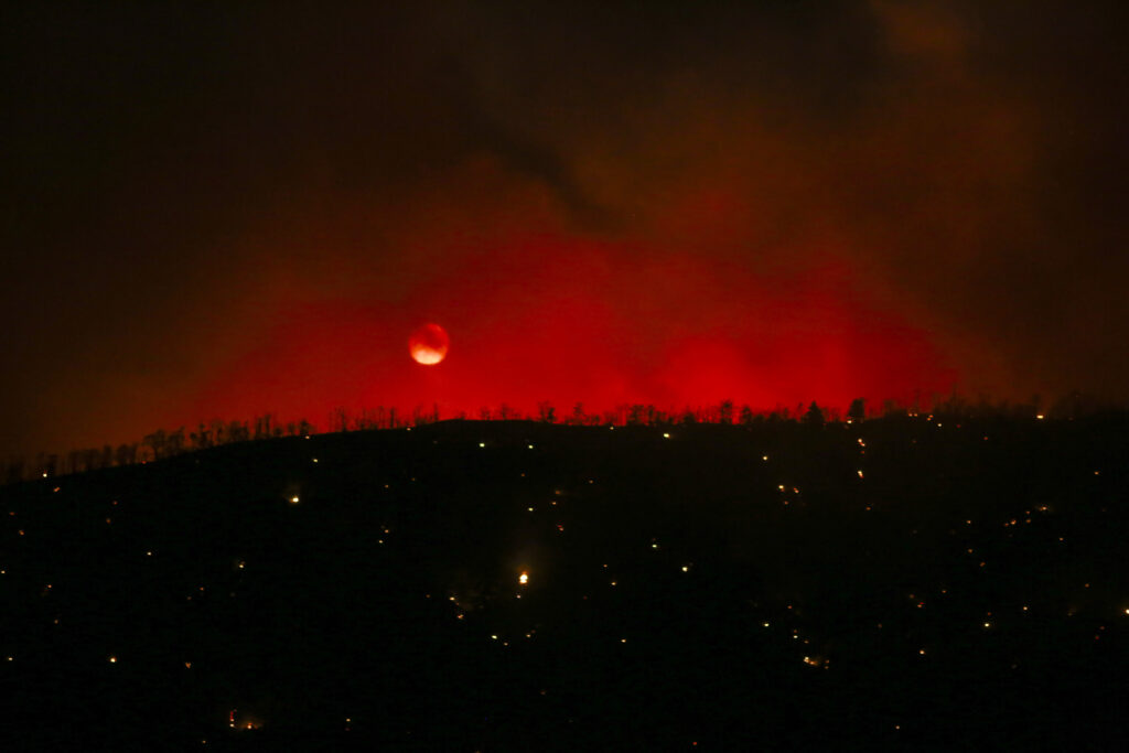
Several hundred homes on the outskirts of Flagstaff, Arizona, were evacuated and the Arizona Snowbowl ski resort was closed as a precaution because of a wildfire — the second to hit the area this year.
Crews were expecting gusts up to 50 mph (80 kph) as they battled the blaze that has burned through parts of the footprint left by another springtime fire that destroyed over two dozen homes. No homes have been lost in the fire reported Sunday that has burned about 8 square miles (20 square kilometers).
“It’s literally like déjà vu,” said Coconino County sheriff’s spokesman Jon Paxton. “We are in the same exact spot doing the same exact thing as we were a month and a half ago. People are tired.”
Wildfires broke out early this spring in multiple states in the Western U.S., where climate change and an enduring drought are fanning the frequency and intensity of forest and grassland fires.
The number of square miles burned so far this year is more than double the 10-year national average, and states like New Mexico already have set records with devastating blazes that destroyed hundreds of homes while causing environmental damage that is expected to effect water supplies.
Nationally, more than 6,200 wildland firefighters were battling nearly three dozen uncontained fires that had charred over 1 million acres (4,408 square kilometers), according to the National Interagency Fire Center.
Even in Alaska, forecasters have warned that many southwestern fires have grown exceptionally over the last week, which is unusual for that area. Southwest Alaska normally experiences shorter periods of high fire danger because intermittent rain can provide relief, but since mid-May the region has been hot and windy, helping to dry out vegetation.
Favorable weather Monday helped slow progression of a tundra wildfire just over 3 miles (4.8 kilometers) away from an Alaska Native village. Moderate temperatures and a shift in the wind that had been driving the fire toward St. Mary’s will allow firefighters to directly attack the flames and increase protections for the Yup’ik community.
The lightning-sparked fire is estimated at about 193 square miles (500 square kilometers). It’s burning dry grass and shrubs in southwest Alaska’s mostly treeless tundra.
In California, evacuation were ordered for about 300 remote homes near a wildfire that flared up over the weekend in forest land northeast of Los Angeles near the Pacific Crest Trail in the San Gabriel Mountains.
The blaze saw renewed growth Sunday afternoon and by midday Monday had scorched about 1.5 square miles (3.9 square km) of pine trees and dry brush, said fire spokesperson Dana Dierkes.
“The fuel is very dry, so it acts like a ladder, carrying flames from the bottom of the trees to the very top,” Dierkes said. Crews were also contending with unpredictable winds that were expected to strengthen later in the day, she said.
Aside from mandatory evacuations for some, the remainder of the mountain town of Wrightwood, with about 4,500 residents, was under an evacuation warning. Several roads also were closed.
The fire was 18% contained.
Fire conditions were elevated because of warm and dry weekend weather across Southern California. Monday was expected to be cooler, but another heatwave was expected at midweek, the National Weather Service said.
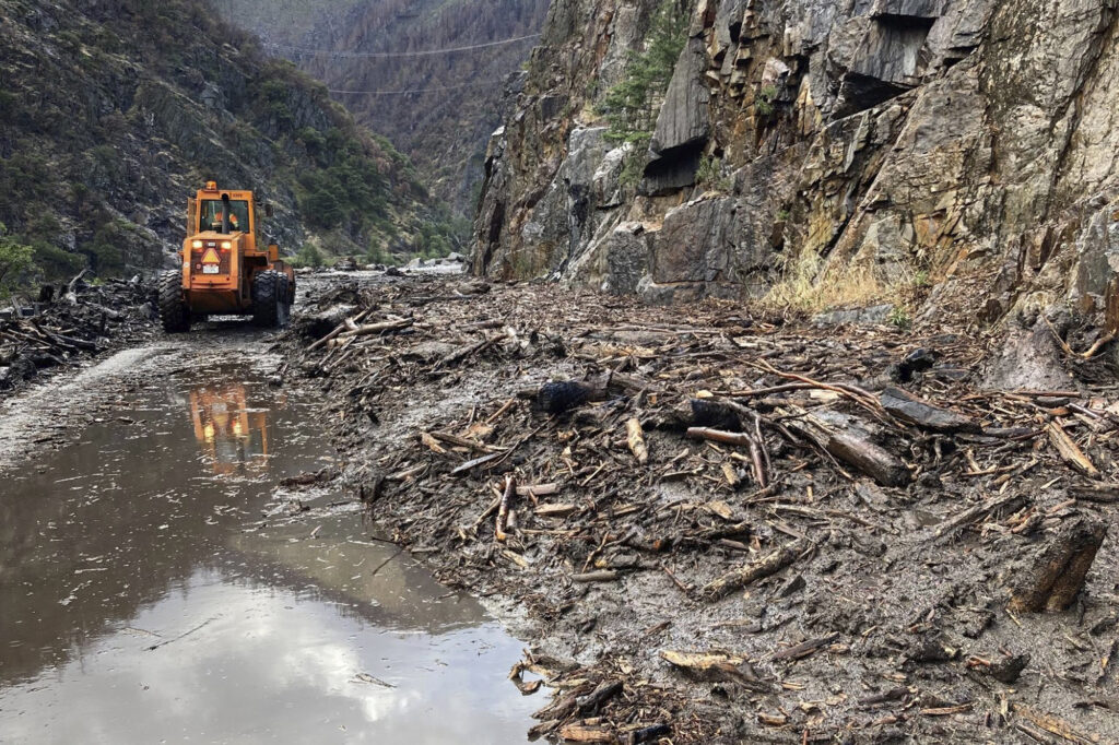
In Northern California, a 50-mile (80-km) stretch of State Route 70 was closed indefinitely on Monday after mud, boulders and dead trees inundated lanes during flash floods along a wildfire burn scar.
Several drivers were rescued Sunday evening from debris flowing on the highway when hillsides burned bare by last year’s enormous Dixie Fire came loose. No injuries were reported.
The causes of the latest California fires were under investigation.
U.S. Forest Service law enforcement officers cited a 57-year-old camper for lighting toilet paper on fire and placing it under a rock Saturday near the origin of the Arizona wildfire. The fire was reported a day later. Court documents show the man told authorities he tried to put the fire out with his sleeping bag, but his attorney said in federal court Monday that doesn’t mean his client was responsible for sparking the blaze.
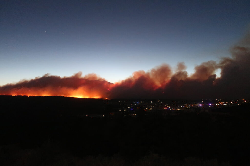
Flagstaff resident Janetta Kathleen rode her horse, Squish, up a hill to get a better look at the wildfire Sunday evening and watched it creep toward homes in the shadow of the mountain. Her home isn’t directly in the fire’s path, but her family, two bulldogs and horses are ready to go at a moment’s notice.
“I need to know what’s going on because I have decisions to make for my family,” she said. “If the winds shift, we’ll be in trouble.”
Hikers, campers and others who were out enjoying the forest also had to leave Sunday. A shelter was set up at a middle school.
Strong winds sent embers across U.S. Route 89, the main route to the turnoff for the Grand Canyon’s east rim entrance, through the Navajo Nation and up into Utah. Many people commute between the reservation and Flagstaff for work. Parts of the highway remained closed Monday.
“We’re not working directly on suppressing the fire to get the whole thing out right now,” said Coconino National Forest spokesman Brady Smith. “That’s not our focus and it’s not possible right now. Right now, it’s going to be focused on protecting life and property.”
Smoke from the fire near Flagstaff caused hazy skies in Colorado on Monday, obscuring views of the Rocky Mountains from Denver and other cities along the state’s Front Range.
Meanwhile, firefighters worked to contain a small wildfire burning in juniper and pinion pine that briefly caused evacuation orders Sunday in the San Luis Valley’s Rio Grande National Forest in southern Colorado.
The National Weather Service issued red flag warnings for high fire danger in central and southern parts of Colorado as well as parts of Arizona, New Mexico and Utah.
Winds are expected to ease after Monday with some moisture moving in later this week in parts of the Southwest, the weather service said.
___
By FELICIA FONSECA
Associated Press writers Christopher Weber in Los Angeles; Mark Thiessen in Anchorage, Alaska; Jim Anderson in Denver; and Susan Montoya Bryan in Albuquerque, New Mexico, contributed to this report.