Heavy Rains Slam Northeast, Trigger Travel Chaos, Floods \ Newslooks \ Washington DC \ Mary Sidiqi \ Evening Edition \ Severe thunderstorms drenched the East Coast Thursday, causing floods and widespread travel delays. Major highways closed, rail services were suspended, and thousands lost power across multiple states. Officials declared emergencies and urged residents to stay indoors amid flash flood warnings.
Quick Looks
- Storms dumped 2–6 inches of rain across Northeast
- Flash flooding hit New York, New Jersey, Pennsylvania, and Maryland
- New York’s Clearview Expressway closed in both directions
- LIRR suspended major rail line during rush hour in Queens
- Flight delays and cancellations reported at NYC, NJ, and Philadelphia airports
- Tornado warnings in New Jersey issued, but no touchdowns confirmed
- Over 6,000 power outages reported across the region
- Emergency declarations issued for NYC and New Jersey
- Water rescues reported north of Baltimore, MD
- Rainfall reached 3 inches per hour in some areas
Deep Look
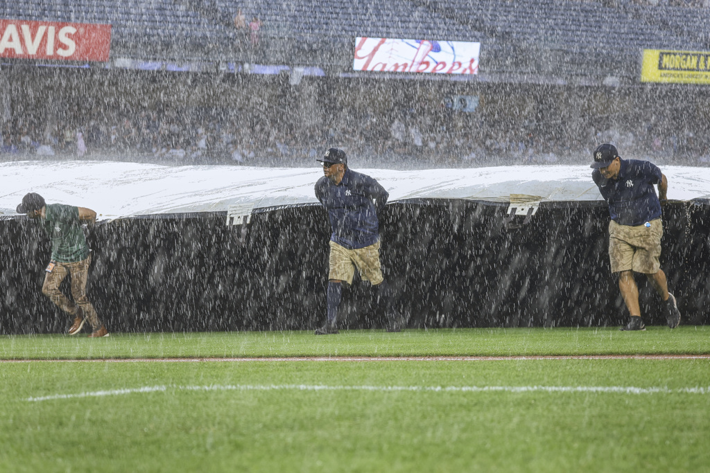
A powerful line of severe thunderstorms and torrential rainfall battered the East Coast on Thursday, causing widespread flooding, travel chaos, and emergency declarations from Philadelphia to New York City. The storm system, described by forecasters as a “high-impact event,” delivered rainfall at dangerous rates of up to 3 inches per hour, overwhelming roads, halting rail systems, and triggering flash flood warnings across multiple states.
In New York, the Clearview Expressway, a vital artery through Queens, was shut down in both directions due to impassable floodwaters. Meanwhile, the Long Island Rail Road suspended service on one of its busiest commuter lines during the evening rush hour, leaving thousands scrambling for alternate ways home. City officials warned that subway stations and basements were at risk, and urged New Yorkers to remain indoors through Friday.
Throughout the day, social media lit up with images and videos of submerged cars, flooded underpasses, and first responders rescuing stranded motorists. In Reading, Pennsylvania, dramatic footage showed water gushing down city streets and reaching halfway up parked vehicles, making commercial areas nearly impossible to traverse.
In northern Maryland, emergency responders carried out multiple water rescues as flash floods swamped neighborhoods north of Baltimore. The National Weather Service issued early afternoon flood warnings for Berks, Lancaster, and York counties in Pennsylvania, as well as Baltimore and Harford counties in Maryland, citing concerns for rising streams, poor drainage, and water pooling in low-lying areas.
By evening, flash flood warnings were expanded to include much of New York City, New Jersey, and Philadelphia. State leaders responded quickly: New York Governor Kathy Hochul and New Jersey Governor Phil Murphy each declared states of emergency. State workers were dismissed early in both states as officials prepared emergency response teams for what forecasters warned could be a long night of severe weather.
Air traffic was no better. Major airports across the region—JFK, LaGuardia, Newark, and Philadelphia International—reported dozens of delays and cancellations. Travelers experienced cascading disruptions as flights were rerouted or grounded entirely due to the intensity of the storms and low visibility conditions.
Forecasters warned that the strongest storms were expected late Thursday into early Friday, with the potential for 2 inches of rain per hour, frequent lightning, and wind gusts reaching 60 mph (97 kph). In eastern Pennsylvania, a severe thunderstorm warning was posted between Allentown and Reading, with reports of penny-sized hail and possible tree damage.
New York City officials issued a rare flooding advisory asking residents—especially those living in basement apartments—to move to higher floors and avoid unnecessary travel from Thursday afternoon through Friday afternoon. The city’s Office of Emergency Management activated its flash flood alert protocols, warning of inundation in subway stations, underpasses, and residential neighborhoods.
In New Jersey, tornado warnings were briefly issued in parts of the state, though no confirmed touchdowns were reported. The rapid weather changes kept emergency responders on high alert, as wind damage and potential funnel cloud sightings were evaluated in real time.
By Thursday evening, over 6,000 utility customers across the region were without power, adding to the disruption caused by fallen trees, flooded substations, and lightning strikes.
Officials in Nassau County, New York, took the unusual step of issuing a direct appeal to residents to shelter in place. “Stay home this evening unless it’s absolutely necessary for you to go out,” said County Executive Bruce Blakeman, emphasizing the risk of driving into floodwaters or being caught in the worst of the storm’s fury.
Across the mid-Atlantic and Northeast, flood watches and severe weather warnings remain in effect into Friday, with some areas forecast to receive up to 6 inches of rain. The National Weather Service said that the Washington–Philadelphia–New York City corridor would remain a high-risk zone for both flash flooding and isolated severe thunderstorms.
Pennsylvania Governor Josh Shapiro said on social media that state emergency agencies were on standby and preparing potential recovery operations, including coordination with local governments in flood-prone areas.
The latest round of intense East Coast weather underscores a growing trend: increased storm intensity, rapid rainfall, and urban flooding, straining infrastructure and testing emergency preparedness across some of the country’s most densely populated areas.
As Friday approaches, officials across the region are asking one thing of residents: stay indoors, stay informed, and don’t underestimate this storm.
Heavy Rains Slam Heavy Rains Slam