Hurricane Erin Disrupts East Coast Beach Plans/ Newslooks/ WASHINGTON/ J. Mansour/ Morning Edition/ Hurricane Erin is churning offshore but already wreaking havoc along the U.S. East Coast. Beaches are closed, evacuation orders are issued in North Carolina, and life-threatening rip currents persist from Florida to New England. Forecasters warn of powerful surf, rising tides, and potential flooding through the weekend.

Hurricane Erin Threatens East Coast: Quick Looks
- East Coast Disrupted: Summer beach plans halted from Florida to New England due to Hurricane Erin.
- Beaches Closed: Swimming bans issued in New York, New Jersey, Delaware, and Massachusetts.
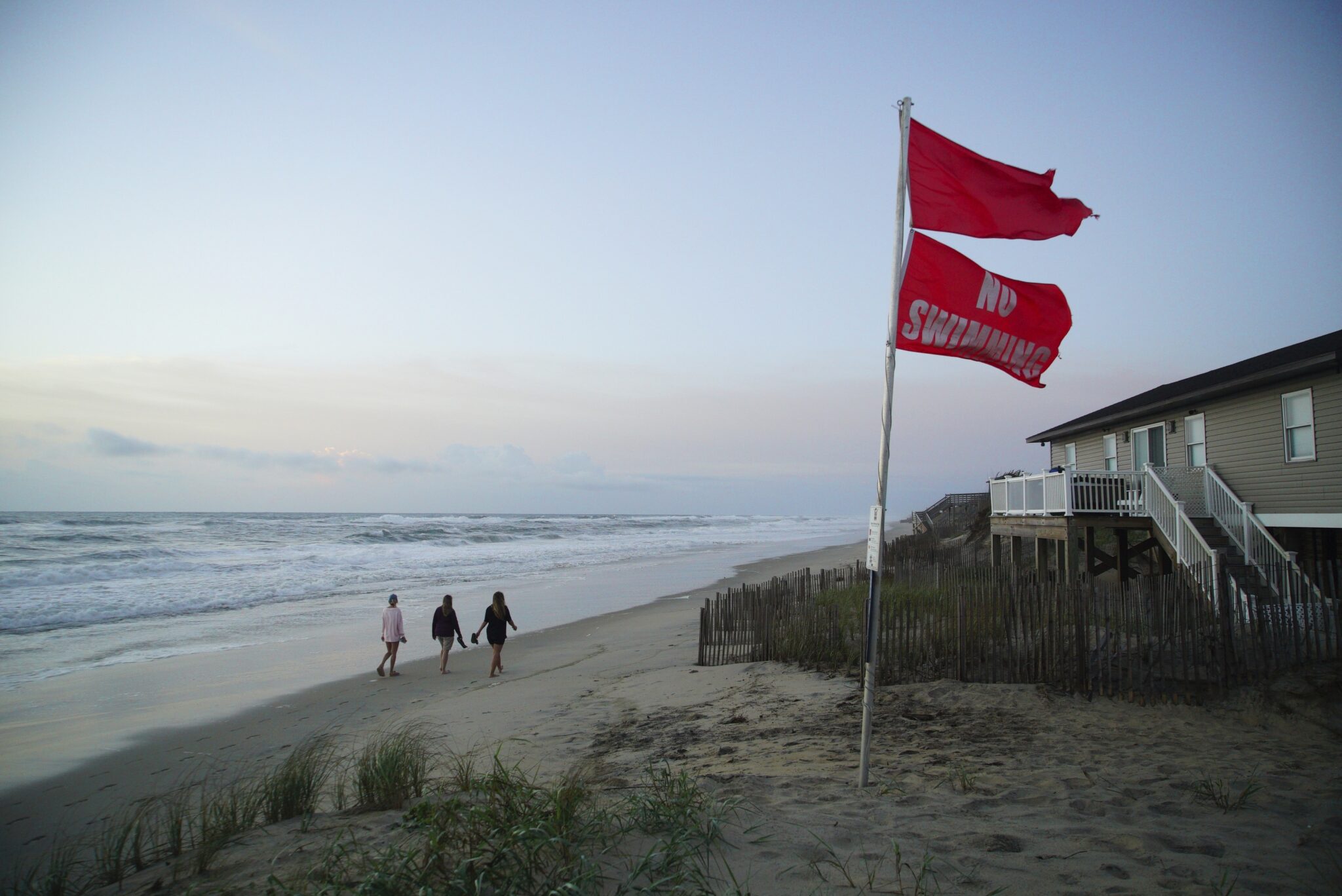
- Evacuations Ordered: Outer Banks areas including Hatteras and Ocracoke Islands evacuated.
- Storm Size & Reach: Erin’s tropical storm winds extend 265 miles from its center.
- Weather Warnings: Tropical storm watches in effect for VA, NC, and Bermuda.
- Flood Risk Grows: Surf could reach 15 feet on North Carolina’s Outer Banks.
- Historical Fears: Locals still recall Hurricane Dorian’s 2019 devastation.
- Climate Concern: Warmer oceans fueling more powerful Atlantic hurricanes.

Deep Look: Hurricane Erin Upends Coastal Life as Summer Ends
RODANTHE, N.C. (AP) — The final weeks of summer along the U.S. East Coast are being overshadowed by the growing threat of Hurricane Erin. Stretching its powerful arms from Florida to New England, the hurricane has prompted emergency orders, beach closures, and warnings of treacherous surf and rip currents expected to last through Friday.
Though the eye of Hurricane Erin is forecast to remain offshore, its outer bands are already battering coastal communities. The National Weather Service warns of dangerous conditions, including waves as high as 15 feet, 100 mph (155 kph) winds, and strong rip currents. These conditions are a particular danger for the millions hoping to enjoy beach vacations before summer fades.
In New York, officials took no chances. Swimming was banned at all city beaches on Wednesday and Thursday. Governor Kathy Hochul also restricted access to three Long Island state beaches. Similar closures spread southward, affecting shorelines in New Jersey, Delaware, and parts of Massachusetts, including 10-foot swells anticipated off Nantucket.
But it’s the Outer Banks of North Carolina that faces the most immediate danger. The area’s fragile barrier islands are exposed to storm surges and rising tides, prompting officials to issue mandatory evacuations for both Hatteras and Ocracoke Islands. Over 1,800 people evacuated Ocracoke by ferry as of Monday.
Despite the growing threat, not all locals are leaving. Longtime residents like fishing charter operator Tom Newsom, who has weathered storms for nearly four decades, are staying put. Calling Erin “a nor’easter on steroids,” Newsom says he’ll ride it out.
However, state and local officials are urging caution. Governor Josh Stein declared a state of emergency and mobilized response teams. Bulldozers reinforced sand dunes, while electrical crews prepared to restore service in the event of widespread outages. Roads are already showing signs of flooding, and emergency workers worry the storm surge may wash out key portions of Highway 12, the Outer Banks’ main thoroughfare.
Further inland, the fear is more about infrastructure damage than personal safety. Cape Hatteras National Seashore Superintendent David Hallac voiced concern for dozens of beach homes that remain vulnerable after years of erosion and dune loss. Already, some residents are preparing properties by removing pier planks and sandbagging vulnerable areas.
At sea, Erin is an expansive and evolving system. The storm’s winds stretch 265 miles from its center, and the National Hurricane Center expects it to expand further. Although it has weakened slightly to a Category 2 storm with sustained winds around 100 mph, its size and structure make it especially dangerous. As of Wednesday morning, Erin was located about 400 miles southeast of Cape Hatteras.
Tropical storm watches have been issued for parts of North Carolina, Virginia, and Bermuda. Earlier in the week, Erin struck the Turks and Caicos and parts of the Bahamas, prompting government closures and stay-at-home orders.
The National Hurricane Center continues to monitor Erin closely as it moves northward into the open Atlantic. However, its indirect impacts—coastal flooding, dangerous surf, and long-lasting beach disruptions—could linger far beyond its closest approach.
Climate scientists highlight Erin as a product of broader trends in hurricane activity. With ocean temperatures rising, storms like Erin are more likely to form and intensify quickly. Experts point to Hurricane Lee in 2023 as a similar system that unexpectedly strengthened and caused extensive coastal damage despite not making landfall.
As summer slips away and schools prepare to reopen, thousands of East Coast residents and vacationers find themselves trading beach towels for sandbags, facing the sobering reminder that hurricane season is far from over.