Tornado and Flood Warnings Issued in Kansas City \ Newslooks \ Washington DC \ Mary Sidiqi \ Evening Edition \ Severe storms brought flash flooding and multiple tornado warnings to the Kansas City area on Tuesday afternoon. Rainfall of up to 3 inches per hour, damaging winds, and rotating cells posed serious threats. Several counties remain under tornado watches as emergency crews respond to storm-related incidents.
Quick Looks
- Flash Flood Warning issued through Tuesday evening.
- Rainfall rates reached 1–3 inches per hour.
- Multiple tornado warnings issued throughout the day.
- Several Missouri and Kansas counties under Tornado Watch.
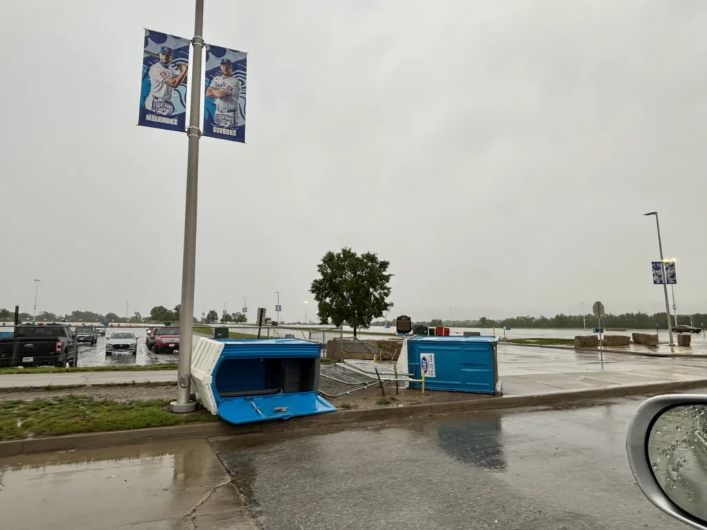
- Strong straight-line winds and embedded tornado circulations possible.
- Ambulance towed in Raytown after dodging fallen tree.
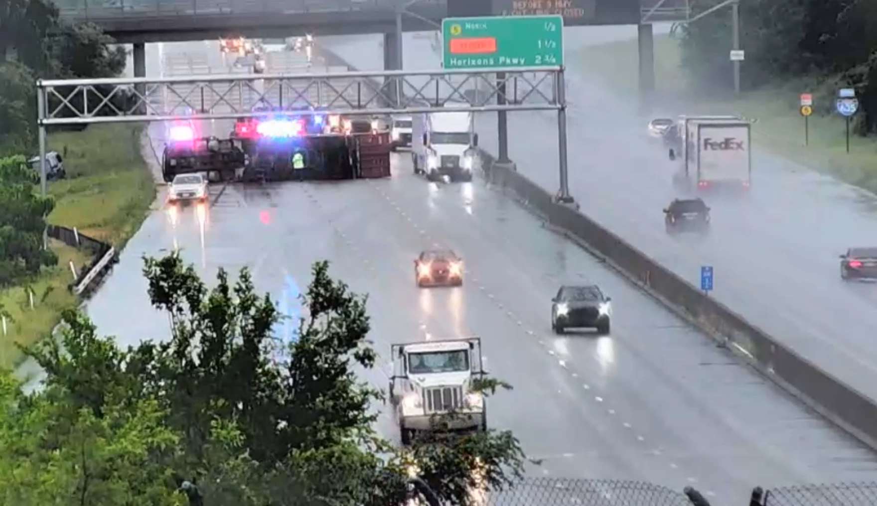
- Crash involving semi snarls traffic on I-635 in Kansas.
- Flooding reported along Indian Creek in Kansas City.
- New round of Severe Thunderstorm Warnings issued mid-afternoon.
- Emergency crews on high alert for flash flooding.
Deep Look
Tuesday’s severe weather outbreak delivered a fast-moving and volatile mix of tornado threats, torrential rainfall, and widespread flash flooding across the Kansas City metro, overwhelming emergency services and disrupting afternoon traffic while threatening millions with dangerous conditions.
The National Weather Service (NWS) issued a series of tornado watches, tornado warnings, severe thunderstorm warnings, and flash flood warnings throughout the afternoon and into the evening. What began as a line of heavy thunderstorms moving from the west quickly developed into a multi-hazard weather emergency as storm cells intensified over northeast Kansas and northwest Missouri.
Torrential Rainfall and Flash Flooding
The foremost concern during the early afternoon was rainfall rates of 1 to 3 inches per hour, with storm cells carrying a history of 0.5 to 2.5 inches of rain elsewhere. This rapid accumulation overwhelmed urban drainage systems, particularly along vulnerable areas like Indian Creek, where flooding was confirmed by mid-afternoon.
The NWS issued a Flash Flood Warning at 2:17 p.m., covering multiple counties in both states, including Wyandotte, Miami, Johnson, and Leavenworth in Kansas, and Platte, Ray, Cass, Clay, and Jackson in Missouri, valid until 7 p.m. The situation on the roads quickly deteriorated, with water pooling on major interstates such as I-35, I-435, and I-635, creating a nightmare for commuters and emergency responders.
Tornado Warnings and Embedded Rotation
At the same time, radar-indicated tornadic circulations prompted a wave of tornado warnings that triggered emergency alerts on phones and local broadcasts. The first Tornado Warning of the day was issued at 1:46 p.m. for Miami and Johnson Counties in Kansas, later extending to Cass and Jackson Counties in Missouri.
The danger escalated with warnings expanding to Ray, Lafayette, Clay, and Jackson Counties by 2:24 p.m., marking the onset of a dangerous tornadic threat within a fast-moving line of storms. These embedded tornadoes are particularly dangerous because they are often wrapped in rain, making them difficult to detect visually.
Emergency Incidents and Road Disruptions
The weather not only triggered alerts but also led to a number of weather-related emergencies:
- At 2:30 p.m., a Tornado Warning was extended for the Kansas City metro area, while drivers on I-35 had to navigate through rising floodwaters.
- By 2:35 p.m., a crash at I-435 and Raytown Road further compounded traffic congestion during peak rainfall.
- In Raytown, an ambulance responding to an emergency had to be towed after it swerved to avoid a falling tree, highlighting the widespread wind damage in residential areas.
- At 3:02 p.m., emergency crews were dispatched to a serious injury crash involving a semi-truck on I-635 near Parallel Parkway in Wyandotte County, Kansas.
Shifting Focus from Tornadoes to Floods
As the storms moved east and began to lose their tornadic characteristics, officials warned that the greater danger had shifted to flash flooding. At 3:50 p.m., the NWS emphasized the need to monitor flooded roadways, creek levels, and rising water in basements and underpasses.
Although no tornado touchdowns had been confirmed by 5 p.m., meteorologists remained cautious. “These embedded rotations can still spin up dangerous conditions with very little warning,” one local weather anchor said during a live update. “We’ve seen similar systems surprise us before.”
Timeline of Major Alerts (All Times Central)
- 1:12 p.m. – Flash Flood Warning for Atchison, Leavenworth, Wyandotte (KS) and Platte (MO).
- 1:32 p.m. – Severe Thunderstorm Warning for multiple counties with 60 mph winds and nickel-sized hail.
- 1:39 p.m. – Tornado Watch issued for 20+ counties.
- 1:46 p.m. – Tornado Warning for Miami and Johnson Counties (KS).
- 2:01 p.m. – First Tornado Warning expires as new ones issued.
- 2:08–2:24 p.m. – Tornado Warnings spread into Jackson, Cass, Clay, Ray, and Lafayette Counties.
- 2:30–2:55 p.m. – Warnings continuously updated, expanded, or extended.
- 3:14–3:50 p.m. – Flood risk surpasses tornado risk as storm tracks shift northeast.
- 4:21 p.m. – Multiple counties removed from Tornado Watch list as storms weaken.
Political and Emergency Response
Local emergency management agencies and the Missouri State Highway Patrol urged drivers to stay off flooded roads and follow detour instructions. The City of Kansas City, Missouri, activated its emergency operations center to monitor conditions, and multiple shelters were prepped in anticipation of possible evacuations in flooded areas.
While Governor Mike Parson did not issue a formal disaster declaration Tuesday, state agencies confirmed that MO Task Force 1 was on standby should further deployment be needed.
Kansas Governor Laura Kelly’s office stated it was coordinating with local emergency services in Wyandotte and Johnson Counties as they dealt with flash flooding and traffic disruptions. No state of emergency had been declared by late Tuesday evening.
What Comes Next?
The storm system is expected to weaken overnight, but additional rainfall could still lead to re-flooding in saturated areas. The National Weather Service warns that conditions may redevelop into scattered thunderstorms through Wednesday, with localized flooding still possible.
Residents are urged to continue monitoring NOAA Weather Radio, local news stations, and emergency alerts, especially those in low-lying or poorly drained areas. “Turn around, don’t drown,” officials reminded those considering driving through standing water.
Takeaways
The June 4th weather event demonstrated the unpredictable nature of Midwest severe weather. What started as a thunderstorm threat quickly escalated into a multi-hazard emergency, combining flash floods, embedded tornado warnings, damaging winds, and dangerous road conditions. The lack of confirmed tornado touchdowns offers a small relief, but the widespread impact of flooding, wind damage, and road closures made it one of the most disruptive weather days of 2025 for the Kansas City region so far.