Tornado Hits Fraser, Michigan Braces for More \ Newslooks \ Washington DC \ Mary Sidiqi \ Evening Edition \ A tornado touched down in Fraser, Michigan, on Wednesday. Southern Lower Michigan remains under a severe thunderstorm watch until 10 p.m. Forecasters warn of more storms, potential flooding, and hail threats.

Quick Looks
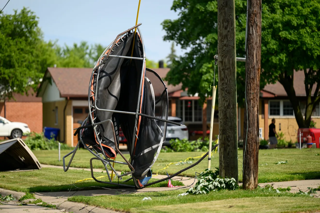
- Tornado confirmed in Fraser, Macomb County Wednesday afternoon.
- Severe thunderstorm watch until 10 p.m. across 21 southern Michigan counties.
- Watch includes areas from Van Buren County to Metro Detroit.
- NWS tracks system moving from northern Indiana with 60–65 mph winds.
- Detroit Tigers reschedule game due to incoming storms.
- Flash flooding risk highest in Macomb County and low-lying areas.
- Rainfall could reach 1.5 to 2 inches in localized areas.
- Storm threats extended to northwest Ohio and southwest Michigan.
- Tornado watch in effect for parts of Michigan and Indiana.
- Public urged to monitor alerts as warnings could replace watches.
Deep Look
Southern Lower Michigan is under high alert following the confirmation of a tornado in Fraser, Macomb County, on Wednesday afternoon. The National Weather Service (NWS) issued a severe thunderstorm watch covering 21 counties across the southern part of the state. This watch, effective until 10 p.m., spans from Van Buren County on the west side of the state, stretches east through Metro Detroit, and reaches north into Lapeer County.
The confirmed tornado in Fraser is currently under investigation by NWS meteorologists, who are determining the twister’s precise wind speed, track, and magnitude. Rich Pollman, the meteorologist in charge at the NWS office in White Lake, emphasized that while confirmation has been made, a complete damage assessment is still in progress.
The storm system that brought the tornado was moving rapidly from northern Indiana into southeastern Michigan. Reports from Indiana detailed wind gusts reaching 60 to 65 mph. As the system crossed state lines, forecasters warned of potential tornadoes, damaging winds, heavy rain, and even hail, though the hail risk diminished by late afternoon.
These developments led to immediate public safety measures. The Detroit Tigers postponed their scheduled Wednesday game against the Pittsburgh Pirates, rescheduling it as part of a doubleheader on Thursday. Organizers cited the safety of fans and players as the primary concern due to the unpredictability of the severe weather.
Rainfall projections have raised concerns about localized flooding, especially in regions already saturated from earlier storms. The Great Lakes Water Authority (GLWA) estimated rainfall totals of 1.5 to 2 inches in some locations, which could overwhelm drainage systems. Macomb County, in particular, remains highly vulnerable due to prior ground saturation. The GLWA urged residents to stay alert and report any issues immediately to local authorities.
Other areas anticipated to experience prolonged rainfall include cities north and west of Metro Detroit, such as Lansing, Flint, and Saginaw. These areas could endure steady rainfall, leading to rising water levels in creeks, streams, and rivers. Local emergency management teams are on standby in case evacuations or rescue operations become necessary.
Meanwhile, weather alerts have expanded beyond Michigan. Thirteen counties in northwest Ohio were also flagged by the NWS for potential severe storms Wednesday evening. In southwest Michigan, Berrien, Branch, Cass, and St. Joseph counties remain under a tornado watch until 8 p.m. These alerts extend into much of Indiana, reinforcing concerns that the region could face multiple severe weather events within a short timeframe.
Authorities are stressing the difference between a watch and a warning. A watch indicates that conditions are favorable for the development of severe weather, while a warning means a tornado or severe storm has been observed by spotters or radar. Residents in the affected areas are urged to have emergency plans in place, ensure mobile devices are fully charged, and monitor reputable news or weather sources closely.
Public safety organizations and meteorological experts have reminded residents that severe storms can escalate rapidly, leaving little time for response. They recommend sheltering in place when warnings are issued, particularly in basements or interior rooms away from windows.
With climate patterns becoming increasingly erratic, weather events like this are becoming more frequent across the Midwest. Meteorologists continue to study storm behavior to improve forecasting models, but the unpredictability of systems like Wednesday’s underscores the importance of community preparedness and real-time response.
As cleanup and assessments begin in Fraser and beyond, emergency crews, meteorologists, and public officials remain on high alert for what the remainder of the evening may bring.
Tornado Hits Fraser Tornado Hits Fraser