Tropical Depression Chantal Sparks Flood Watches In Carolinas, Virginia/ Newslooks/ WASHINGTON/ J. Mansour/ Morning Edition/ Tropical Storm Chantal weakened to a depression Sunday, moving through the Carolinas. Flash flooding threatens central North Carolina and south-central Virginia with rain totals up to six inches. Dangerous surf and rip currents persist from Florida to the mid-Atlantic.


Quick Look:
- Chantal weakened to tropical depression status Sunday
- Flood watches posted in NC and VA through Monday
- Dangerous surf and rip currents continue along East Coast

Chantal Weakens to Depression, Brings Flash Flood Threats in Carolinas and Virginia
Deep Look
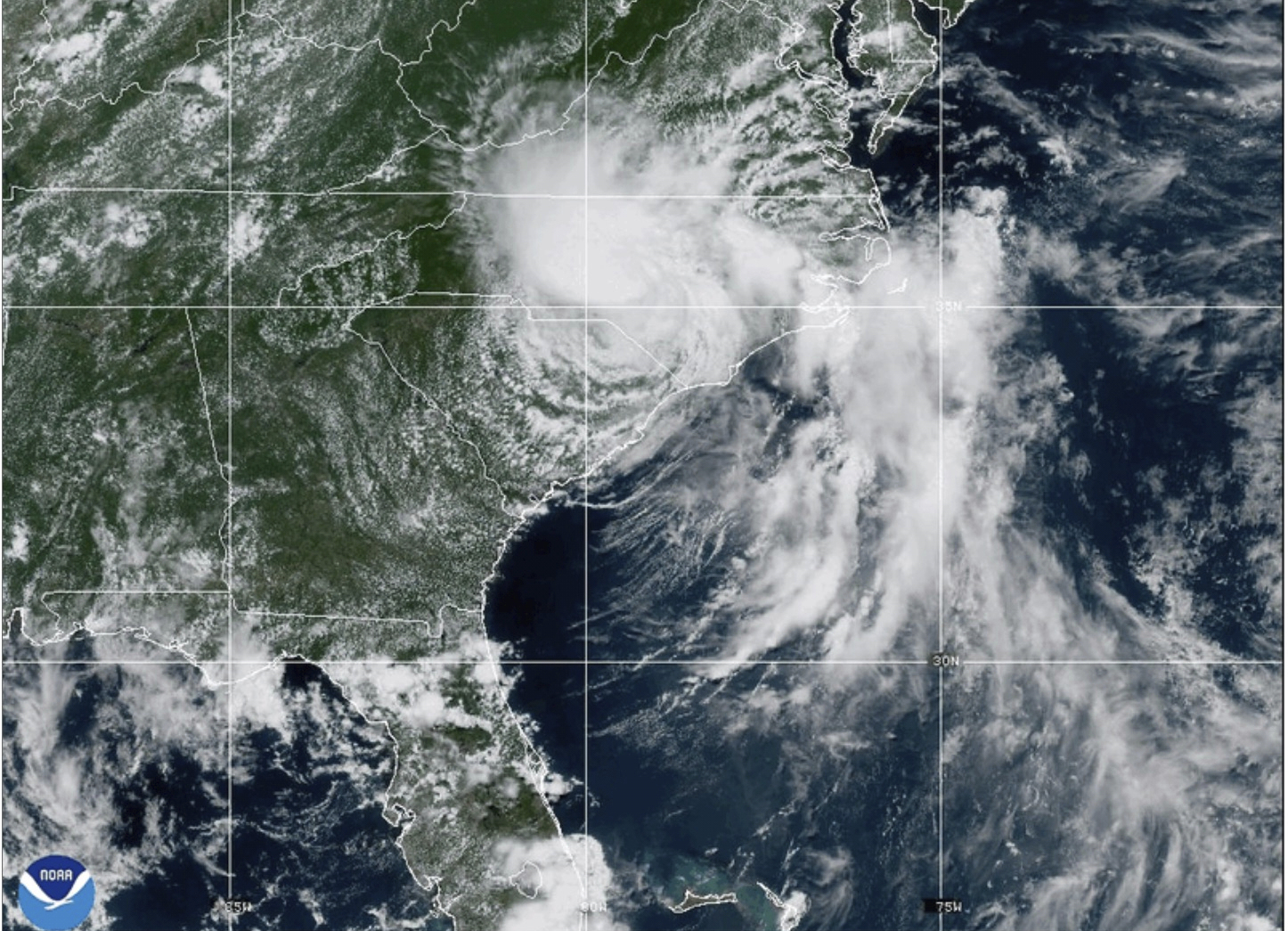
MIAMI (AP) — Tropical Storm Chantal weakened to a tropical depression on Sunday but continued to pose a risk of flash flooding as it churned northward through the Carolinas toward Virginia.
Chantal made landfall near Litchfield Beach, South Carolina, early Sunday around 4 a.m. EDT, according to the National Hurricane Center. By 5 p.m., the storm’s center was about 65 miles (105 kilometers) south-southwest of Raleigh, North Carolina, moving north-northeast at 10 mph (17 kph) with sustained winds of 30 mph (45 kph).
While further weakening is expected as Chantal moves across North Carolina, forecasters said it could gain some strength as it approaches the Virginia Capes on Monday. Flood watches remain in effect across central North Carolina and south-central Virginia through Monday, with rainfall totals of 2 to 4 inches (5 to 10 centimeters) and localized amounts up to 6 inches (15 centimeters) that could trigger flash flooding.
Forecasters also warned of dangerous surf and rip currents continuing along beaches from northeastern Florida to the mid-Atlantic over the next few days.