Winter Storm Slams Great Lakes and Northeast Region/ Newslooks/ WASHINGTON/ J. Mansour/ Morning Edition/ A powerful winter storm is striking the Great Lakes and Northeast with heavy snow, strong winds, and bitter cold after a bomb cyclone tore through the northern U.S., leaving over 150,000 without power. States like Michigan and New York are seeing hazardous conditions, including snow squalls and dangerously low wind chills. The National Weather Service warns the storm’s effects will continue into the week.
Great Lakes Winter Storm Quick Looks
- Bomb cyclone brings snow, ice, and strong winds
- Over 150,000 without power nationwide, Michigan hardest hit
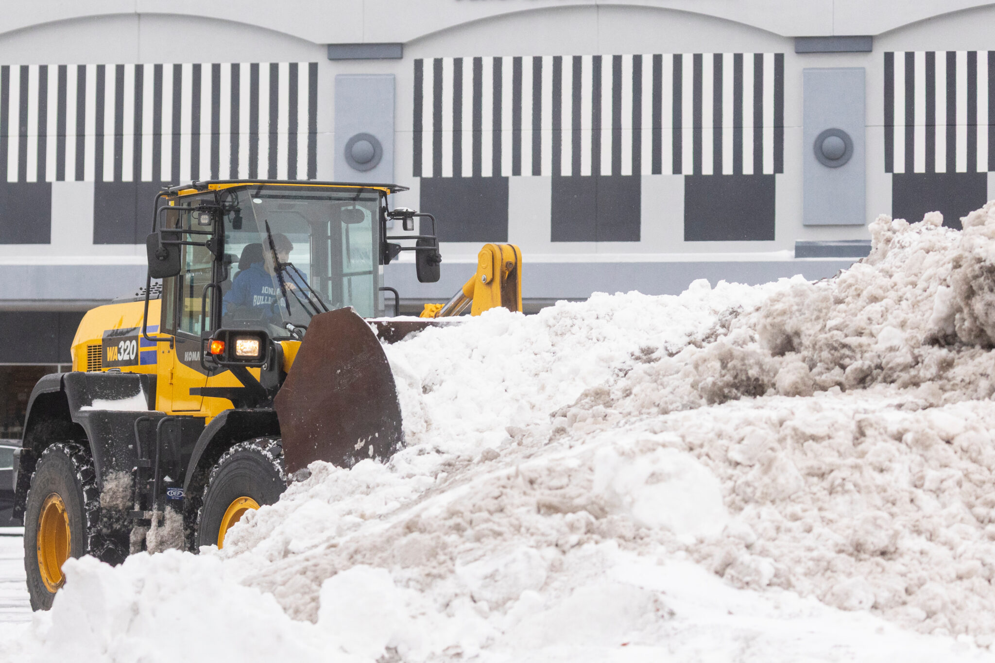
- Snow totals reach 2 feet in Michigan’s Upper Peninsula
- Lake Superior waves hit 20 feet, grounding ships
- Governor Hochul urges travel restrictions amid whiteout conditions
- Snow squalls and minus 30°F wind chills reported
- Santa Ana winds forecast in Southern California
- New Year’s Day storms could drench Rose Parade


Deep Look
Winter Storm Blasts Great Lakes and Northeast with Snow, Wind, and Arctic Cold
A fierce winter storm is hammering the Great Lakes and Northeast on Tuesday, following the path of a powerful bomb cyclone that swept through the northern United States on Monday. The storm brought dangerous conditions including heavy snow, hurricane-force winds, and extreme cold, leaving a trail of power outages and travel chaos in its wake.
The system intensified rapidly, meeting the meteorological threshold for a bomb cyclone — a storm that undergoes explosive strengthening due to a dramatic drop in atmospheric pressure. The result was a sweeping mix of snow, ice, and rain across the Plains and Midwest that caused havoc for holiday travelers.
As of early Tuesday, more than 153,000 customers were without power across the country, according to PowerOutage.us. Michigan alone accounted for more than one-third of those outages as the storm moved eastward into Canada.
Whiteout Warnings and Snow Squalls Ahead
The National Weather Service issued multiple alerts across the Northeast, warning of snow squalls and sudden whiteout conditions. New York Governor Kathy Hochul advised residents in impacted areas, including around Syracuse, to avoid unnecessary travel as weather deteriorates.
“If you’re in an impacted area, please avoid all unnecessary travel,” she posted on X.
In Michigan’s Upper Peninsula, snow accumulations reached up to 2 feet on Monday. Meteorologist Ryan Metzger said more snow was likely in the coming days, though it would not be as intense. Wind gusts and lake-effect snow could still create hazardous driving and whiteout conditions across the region.
Lake Superior and Lake Erie React to Storm Surge
Waves on Lake Superior surged to heights of 20 feet, forcing nearly all cargo ships to seek shelter. According to MarineTraffic.com, only one vessel remained at sea Monday. These wave heights rival past extreme events like the 1975 Edmund Fitzgerald disaster.
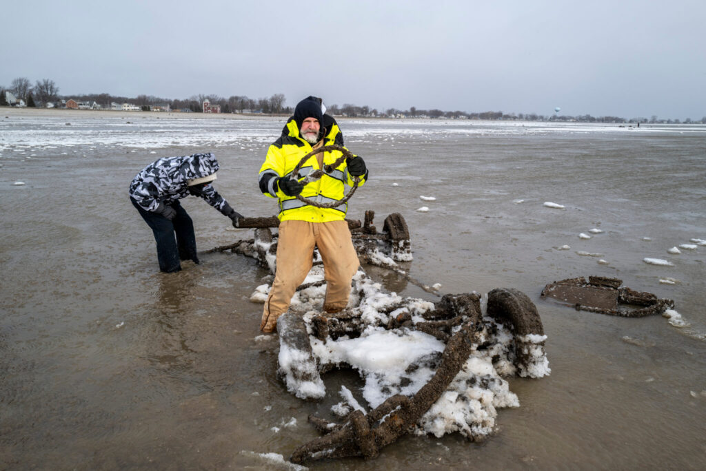
On Lake Erie, the storm created a dramatic seiche effect — pushing water toward Buffalo, New York, while draining levels on the western end in Michigan. In Monroe, Michigan, the water receded so drastically that remnants of 19th-century piers and even a submerged car and snowmobile became visible.
Kevin Aldrich, a local maintenance worker, captured the moment in photos. “Where those are at would typically be probably 12 feet deep,” he said. “We can usually drive our boat over them.”
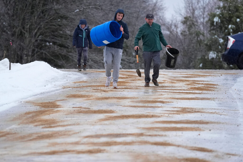
Dangerous Wind Chills and Travel Disruptions
Extreme cold gripped the Upper Midwest, with wind chills dropping as low as minus 30°F (minus 34°C) in parts of North Dakota and Minnesota. In northeast West Virginia, wind speeds near Dolly Sods approached hurricane strength, a rare occurrence for the region.
Blizzard conditions in Iowa subsided by Monday morning, but winds continued to blow snow across roads. Over 200 miles of Interstate 35 remained closed due to low visibility and drifting snow. State officials reported dozens of traffic accidents, including at least one fatality.
Storm Impacts Extend to West Coast
The West Coast isn’t being spared from wild weather either. The National Weather Service warned that moderate to strong Santa Ana winds were expected across parts of Southern California through Tuesday. These dry, powerful winds pose a risk of downed trees and fire hazards, especially in areas with recently saturated ground from earlier storms.
Looking ahead, forecasters predict two more storms will impact the region later this week. Rain is expected on New Year’s Day in Pasadena, potentially soaking the iconic Rose Parade for the first time in nearly 20 years.
Cautious Week Ahead for Millions
As winter grips much of the U.S., forecasters continue to monitor the rapidly changing storm systems. Officials urge the public to stay indoors, avoid travel where possible, and remain prepared for power outages and dangerous conditions. The polar air mass and persistent snow threats are expected to continue well into the first week of January.