The Richard Spring Fire is advancing through southeastern Montana, forcing evacuations of towns. At the same time, California’s Dixie Fire, the largest wildfire in the nation, continues to threaten small communities in the Sierra Nevada. The Associated Press has the story:
Richard Spring Fire in southeastern Montana forces evacuations
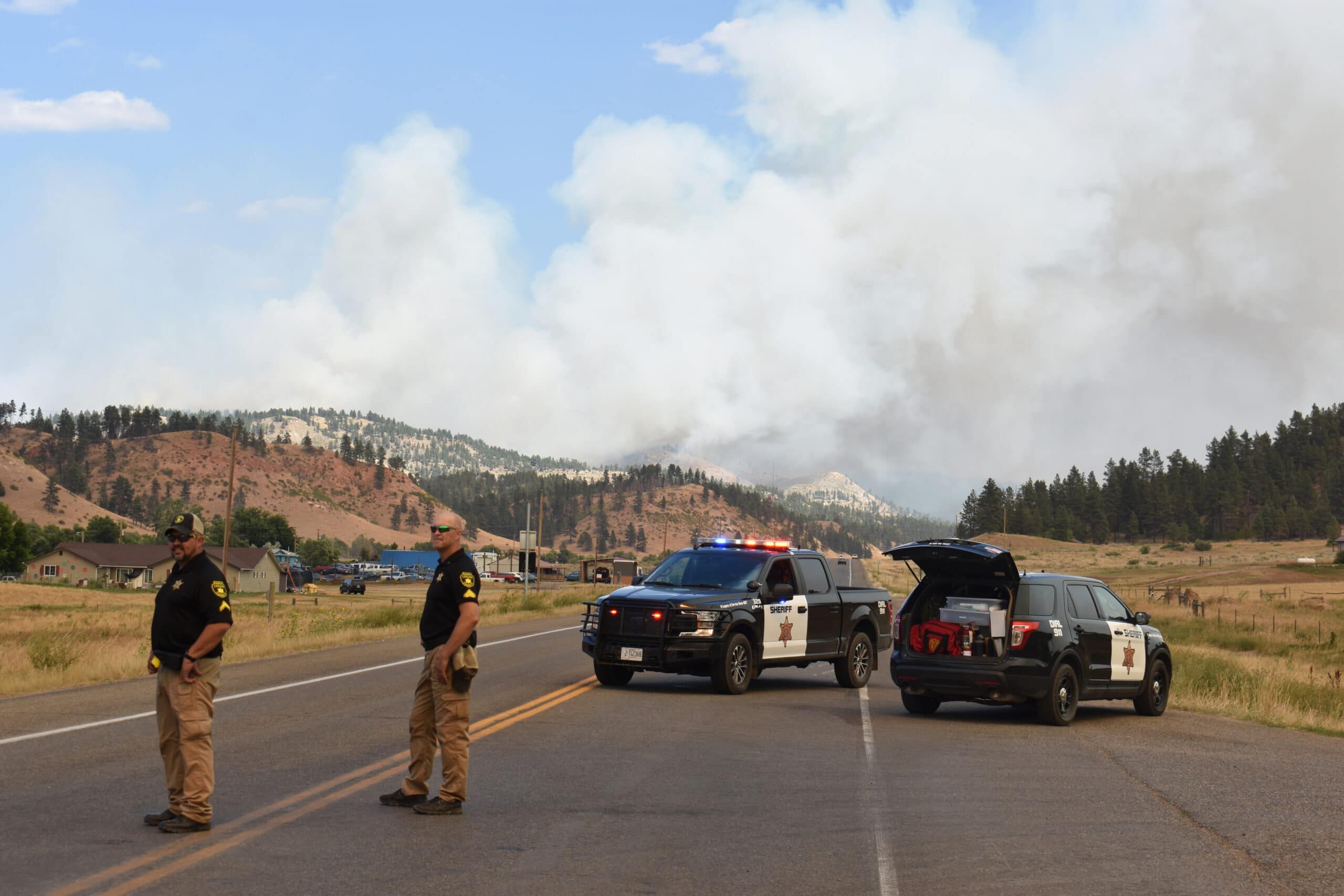
LAME DEER, Mont. (AP) — A wildfire bore down on rural southeastern Montana towns Thursday as hot, dry weather throughout the West drove flames through more than a dozen states.
Several thousand people in Montana remained under evacuation orders as the Richard Spring Fire advanced across the sparsely populated Northern Cheyenne Indian Reservation.
Meanwhile, California’s Dixie Fire — which started July 13 and is the largest wildfire burning in the nation — threatened a dozen small communities in the northern Sierra Nevada even though its southern end was mostly corralled by fire lines.
The fire has burned 790 square miles (2,000 square kilometers), destroyed some 550 homes and nearly obliterated the town of Greenville last week. It was 30% contained.
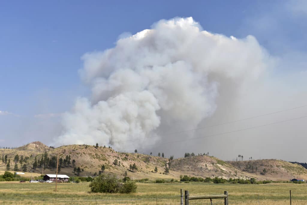
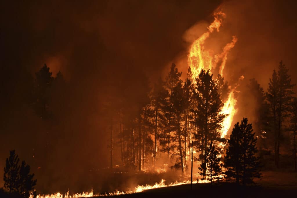
Primed by heavy, swirling winds and hot temperatures, the Montana fire spread in multiple directions, torching trees and sending off embers that propelled the flames across the dry landscape.
The blaze began Sunday and winds gusting up to 56 mph (90 kph) caused it to explode across more than 260 square miles (670 square kilometers) by Thursday.
The fire has now crept within about a mile (3.2 kilometers) of the eastern edge of the evacuated town of Lame Deer, Northern Cheyenne Tribe spokesperson Angel Becker said. It passed over a highway where officials had hoped to stop it late Wednesday, putting the southern portion of the reservation at increased risk, officials said.
As it closed in on the east side of town and a second fire ignited to the west, tribal officials late Wednesday urged residents who did not heed the initial evacuation order to flee. Buses were brought in to move people to a school in Busby, about 15 miles (24 kilometers) away, and to the shelter set up on the nearby Crow Indian Reservation.
“We had some people who refused, but the majority of our elders and women and children had definitely left with that last push,” Becker said.
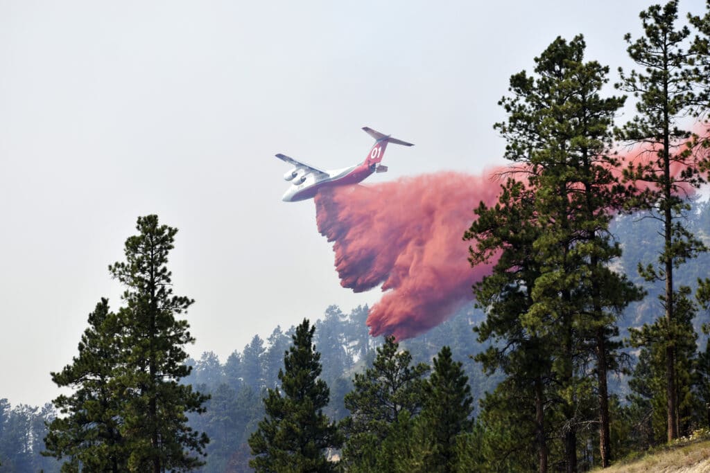
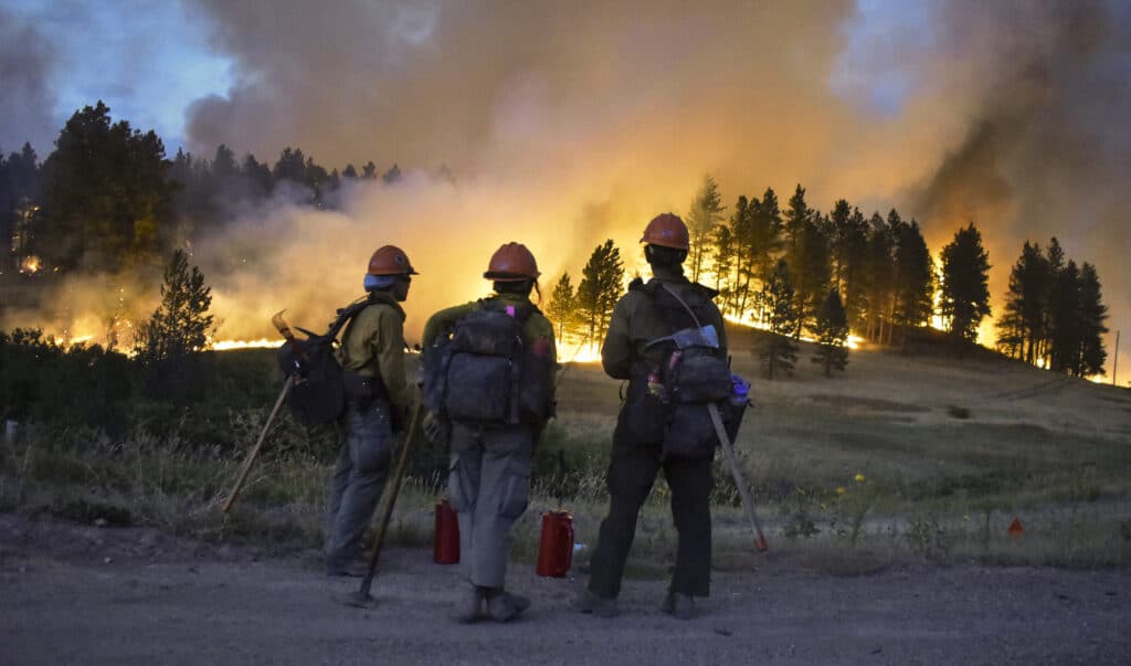
Firefighters worked into early Thursday morning on hills around Lame Deer to keep the blaze from destroying houses. No houses were reported destroyed, but fire officials were assessing the damage and said more than dozen sheds and other outbuildings had been lost.
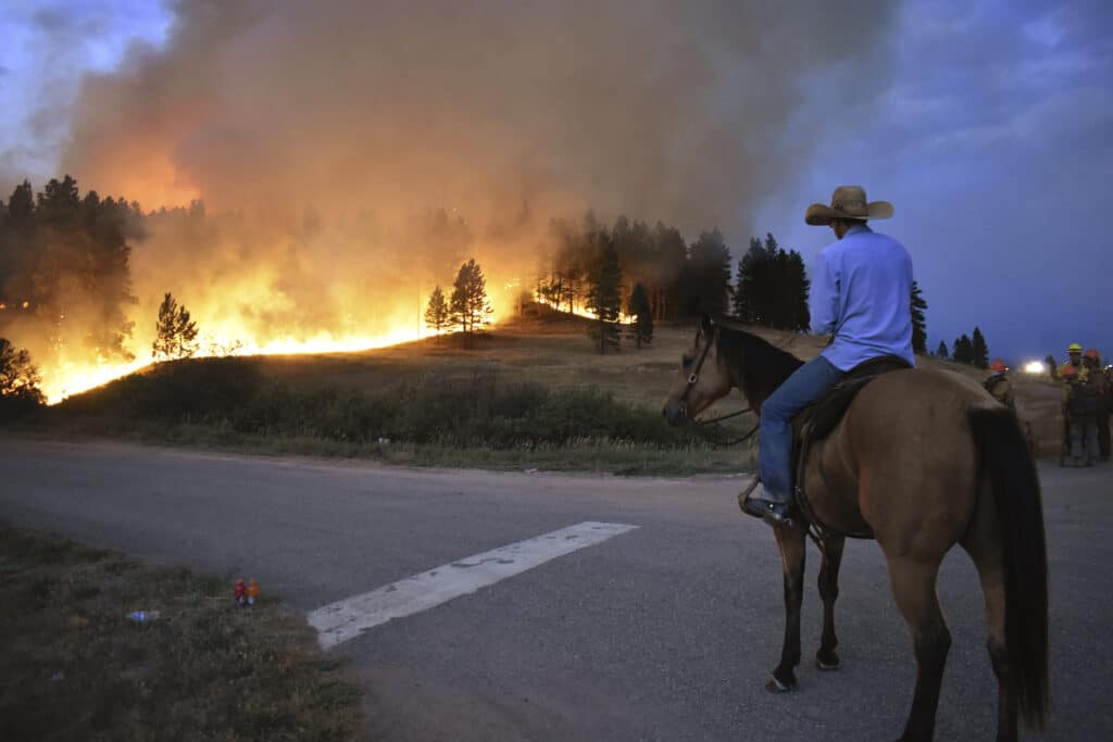
Rancher Jimmy Peppers sat on his horse east of town, watching an orange glow grow near the site of his house as the night wore on.
“I didn’t think it would cross the highway so I didn’t even move my farm equipment,” said Peppers, who spent the afternoon herding his cattle onto a neighbor’s pasture closer to town. “I don’t know if I’ll have a house in the morning.”
The town of about 2,000 people is home to the tribal headquarters and several subdivisions and is surrounded by steep, rugged, forest.
A few miles from town, Krystal Two Bulls and some friends stuck around to clear brush from her yard in hopes of protecting it from the flames. Thick plumes of smoke rose from behind a tree-covered ridgeline just above the house.
“We’re packed and we’re loaded so if we have to go, we will,” Two Bull said. “I’m not fearful; I’m prepared. Here you don’t just run from fire or abandon your house.”
Also ordered to leave were about 600 people in and around Ashland, a small town just outside the reservation. Local, state and federal firefighters were joined by ranchers using their own heavy equipment to carve out fire lines around houses.
Ashland remained under an evacuation order but officials said the danger there appeared to have eased for now.
Around the perimeter of Lame Deer, crews were building a fire break using heavy equipment and conducting intentional, strategic burns in hopes of lessening the amount of fuel available on the ground, said fire spokesperson Jenny Garcin.
Cooler weather and less wind was in the weather forecast for southeastern Montana Thursday, the National Weather Service said. That could give firefighters brief relief before a ridge of high pressure moves into the area and pumps temperatures into the 90s over the weekend.
Extreme drought conditions have left trees, grass and brush bone-dry throughout many Western states, leaving them ripe for ignition. Montana alone had 25 large wildfires burning, according to the National Interagency Fire Center.
At the same time, California and some other states were facing flows of monsoonal moisture that were too high to bring real rain but could create thunderstorms that bring new fire risks of dry lightning and erratic winds.
In Northern California, a number of wildfires and the threat of more prompted three national forests to close down the Trinity Alps Wilderness Area, a 780-square mile (2,000-square kilometer) area of granite peaks, lakes and trails, into November.
“Tracking hikers in unsafe areas pulls much-needed aircraft away from firefighting efforts, and adds risk and exposure to first responders. Additionally, forest managers hope to limit the possibility of human-caused fires with this temporary full closure,” Shasta-Trinity National Forest officials said in a statement.
Scientists have said climate change has made the region much warmer and drier in the past 30 years and will continue to make the weather more extreme and wildfires more frequent and destructive. The more than 100 large wildfires in the American West come as parts of Europe are also burning.
By MATTHEW BROWN and CHRISTOPHER WEBER |